Signal and image processing

TSI TSI - Signal and image processing
Interested in joining the community ? Before getting involved, I must choose my contribution : simple visitor, occasional participant in events, expert deeply concerned by the field (member) : which status to choose
Become involved Member of the COMET
Expert Only
Subject to validation by the COMET coordinators
OR
Just stay informed about the next COMET’s event

The COMmunity of ExperTs TSI is interested in the following topics :

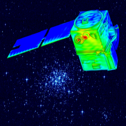
  • Analysis and processing of optical and radar satellite images : Compression, restoration, segmentation, classification…
  • Extraction and analysis of scientific measurements : Altimetry, sounding…
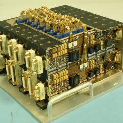
  • Architectures and supports for Embedded processes : Optimization of complexity, architecture…
  • Transmission and localization : Channel coding, filtering, estimation…
  • Propagation - in connection with the Community of Experts ECM (Electromagnetism and Microwave Circuit)
See more
  • Yannick TANGUY Yannick TANGUY
    Animateur
  • Guillaume EYNARD-BONTEMPS Guillaume EYNARD-BONTEMPS
    Ingénieur Calcul Scientifique
  • Xavier BOULANGER
    Ingénieur
  • 9 July 2024
    from 08H45 to 17H30
    Find out more

    DATAVIZ. (Outils de) Visualisation avec ou sans Python

    TSI - Signal and image processing
    L'atelier numérique de l'OMP(*) et les COMET vous proposent le 9 juillet à partir de 08h45 : Une journée DATAVIZ, (Outils de) Visualisation avec ou sans Python en salle Coriolis de l'OMP. Le programme en cours de finalisation est en ligne à cette adresse : https://sourcesup.renater.fr/wiki/atelieromp/visu_jt_09juillet2024#programme Le matin : 1/2 journée thématique avec des présentations. 80 places. L'après-midi : atelier de cartographie sous Python (Cartopy et Folium). 12 Places maximum..  Merci de vous inscrire par ...
    • Observatoir Midi Pyrénées, Toulouse, France
    • FR
    • No videoconference
    • Public
  • 27 June 2024
    from 09H00 to 17H00
    Find out more

    Workshop – Results of FormaTerre OIC Challenge 2024

    TSI - Signal and image processing
    Terrain motion is a variable used in various fields of Earth sciences for understanding the physical mechanisms controlling fault, landslide, glacier or volcano activity and can be a key parameter for Disaster Risk Management (DRM) applications. OIC (i.e. pixel offset tracking) can measure surface motion by determining the offset between two satellite acquisitions. In the case of optical satellite with off-nadir look angles, the technique is sensitive to displacement in the ...
    • Hôtel Pullman, Toulouse, France
    • EN
    • Accessible by videoconference
    • Public